Distance: 10.21 miles / 16.43 kilometres
Total ascent: 1,093 feet / 333 metres
Walking time: 3.5 to 4.5 hours
The walk starts from the south side of the A456 Hagley Road (West) between Quinton and Bearwood, at the junction with White Road. From the Hagley Road, follow White Road southwards for 300 metres to the roundabout at the junction with Quinton Lane, at which point cross straight over and continue for a further 150 metres to the junction with Ridgacre Road. There is no crossing near here, so take care as you traverse the dual carriageway. Once you have reached the south side of Ridgacre Road, continue in the same direction for 500 metres to the bottom of White Road. Turn right at the roundabout there, but within 40 metres take the passageway on your left between 71 and 73 Lower White Road.
Having emerged from the 80-metre passageway onto World’s End Lane, continue up Gorsy Road (opposite) for 300 metres to the junction with Quinton Road West. Use the crossing on the left to reach the entrance to Mayswood Grove on the other side. Proceed along Mayswood Grove for 80 metres and then turn left. After a further 50 metres, take the passageway on your right between 74 and 76 Mayswood Grove. After walking 30 metres and descending a few steps, cross over Simmons Drive and continue straight ahead, taking the footpath which bends around the side of the small-windowed terrace. Follow this path downhill for around 400 metres to a bridge over the Bourn Brook. Having crossed the bridge to the south bank of the Bourn Brook, turn right and follow the footpath which runs alongside the stream for approximately 1.9 km.
To reassure yourself that you’re on the right path, look out for a metal-framed footbridge after 900 metres and, after 1200 metres, a signpost pointing you towards Hole Farm and the Urban Farm. You will hear the noise of traffic on the Quinton Expressway. After 1500 metres, there is a bicycle barrier and another metal-framed footbridge. The Bourn Brook should now be on your left, with a muddy track for horses etc. on your right. You may begin to smell the farms ahead. Ignoring a footbridge on your left, continue for the final 400 metres to the conjunction of the path, the muddy track and Watery Lane, which serves Hole Farm and Woodgate Valley Urban Farm. Turn left onto to the track and then immediately right onto Watery Lane. Follow Watery Lane uphill for 100 metres to Carters Lane, which despite its deceptive name is a busy road. Cross straight over Carters Lane and take the road opposite, Lye Close Lane, for 100 metres uphill. At this point you will see a sign on your right for Lapal Lane, a small part of the very ancient East Worcestershire Ridgeway from Dudley in the north to Evesham in the south.
Unlike the hobbits, we will not follow this winding old road through the busy suburbs of west Birmingham. Our path will run parallel to the Ridgeway for around 6 kilometres (4 miles).
Continue up Lye Close Lane for another 350 metres, passing Nailers Close (with its electricity pylon) on the right. At the T-junction after crossing the bridge over the M5, turn left and follow Lye Close Lane for further 150 metres. Where the lane turns right, take the footpath on the inside corner, opposite the driveway of no. 21, and climb over the stile. Walk along the right side of a field for 60 metres to the west corner of the Halesowen Riding School, then use the metal gate to reach the track which leads downhill and away from the riding school. Follow the track for 300 metres (climbing over two more stiles) to reach a perpendicular path lower down. Turn left onto the path between the trees and follow it for 250 metres in the direction of Cooper’s Wood.
Squeeze between two posts and take the righthand way where the path forks at a small stream (the first of many in this valley). After another runnel of the same stream 130 metres further on, take the path up an incline for 100 metres. At the top of this ridge, squeeze between another set of posts and continue downhill for 160 metres. Cross a second stream and then the stile ahead of you to emerge into a field. Turn right and keep to the edge of Cooper’s Wood for 50 metres. Of the choice of two footpaths in the next field, take the righthand one south-westwards and then downhill for 270 metres to the bottom of Lowlands Farm lane. Walk up the lane for 200 metres, passing along the north side of Lowlands Farm until you reach Illey Lane opposite the car park of The Black Horse pub.
Turn left onto Illey Lane but, after 30 metres, turn right onto a track beyond the car park. Follow the track for 400 metres, gently uphill at first and then turning left and downhill into Lower Illey. Keep left at Illey House Farm and follow the track downhill for another 180 metres and across a stream, at which point it turns abruptly left and heads uphill to Lower Illey House. Around 60 metres beyond Lower Illey House, it is necessary to cross a stile (or gate) and then a stream, before the track rises and emerges into a field containing a line of oak trees. Proceed along the right side of the oaks and into the field beyond, at the bottom end of which is another gurgling stream and two footbridges amid the trees. Now head uphill in a westwards direction, along the lefthand side of the next field. After 180 metres, turn left onto The Monarch’s Way footpath. Take path southwards for 400 metres into Twiland Wood, where Dowery Dell railway viaduct used to cross the stream.

Follow The Monarch’s Way southwards for around 2.5 km (1.5 miles). After the railway viaduct the path turns right and continues through Twiland Wood for another 150 metres. It then keeps to the righthand side of a large field for around 500 metres. Cross the farm track that divides the field, also a stream and then bear left. Amid the woods the path begins to rise and, after 180 metres, forks.
Keep right and enter another long field, this time sticking to the lefthand edge. After a further 500 metres, you pass an information board commemorating the crash of a Wellington bomber and the loss of three air crew at this site in 1944. 200 metres after the woods of Long Saw Croft (on your left) end, ignore paths to your left and right and continue uphill along The Monarch’s Way until you reach Newtown Lane. Turn right onto Newtown Lane and walk for 80 metres to the junction with Old House Lane, then left again and cross the bridge over the M5. On the south side of the motorway, pass the turning to Chapman’s Hill on your right and instead take the next right (between two stone jambs) into Waseley Hills Country Park. From this point until Beacon Hill in the Lickeys, we will largely follow the route of the ancient Ridgeway.
Enter the car park of Waseley Hills Country Park straight ahead. Keeping the cars on your left and the café on your right, walk 150 metres to a wooden gate at the bottom of Windmill Hill. Once through the gate, turn right and cross to the opening the western corner of the field. Once there, then left and proceed up the ridge to the top of the hill.

Continue to walk the length of the Waseley Hills but, after 225 metres, instead of going along the spine, take the holloway between the trees on your left (i.e. sticking to The Monarch’s and The North Worcestershire Way). This route bends around the eastern slopes of the hills for around 600 metres, passing near the source of the River Rea, before climbing Holywell Hill. (The path keeps to the left of Holywell Hill’s round top but you may wish to stray briefly to the right to enjoy the views of Worcestershire that it affords.) From Holywell Hill, leave The Monarch’s Way and instead follow The North Worcestershire Way downhill to the Waseley Hills’ South Car Park and to Holywell Lane beyond.
From the metal-gated entrance to the car park, turn left onto Holywell Lane and walk 60 metres to the junction with Whettybridge Road, then turn right and cross the bridge over the A38. At the end of the bridge, on the righthand side, turn off the road and go around the gate on your left. After 500 metres, where there is a division in the path, go left and walk a further 230 metres until reaching the road. Turn right onto Beacon Hill and follow the road uphill for 100 metres to the point where it begins to bend right. There, keep on The North Worcestershire Way as it turns off to the left and uphill through the trees.
After a 250-metre ascent, turn left and across the grass, making for the Beacon Hill toposcope. If you briefly divert in the direction of the car park on your right, you will get a view of Bromsgrove, where Tolkien’s mother is buried. Here, again, we temporarily leave the ancient Ridgeway (for 3 kilometres or 1.8 miles). Enter the coniferous woods by a path on the far side of the toposcope.
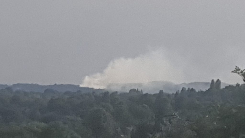
IMPORTANT: Please do not attempt to camp or light a fire in the Lickey Hills. The woods are vulnerable to wildfires, with one in July 2022 devastating the area most beloved by Tolkien, Rednal Hill. I have deliberately chosen to terminate this stage of The Shire Way beside The Old Rose and Crown hotel in Rednal, so that unauthorised camping is unnecessary.
Descend the wooded hillside in a south-easterly direction for around 500 metres. The exact route is difficult to describe and you should refer to the maps I have provided. If in doubt, follow one of the larger tracks downhill.
Having reached the stream which feeds various ponds below (and will become the River Arrow), turn left and follow the path along the lefthand bank for 200-300 metres.

At the north corner of the large duckpond (where there is a café and table-tennis table), bear right and downhill to a smaller pond and The Old Rose and Crown hotel, where the first stage of The Shire Way finishes.
NEXT: Stage 2 of The Shire Way