Distance: 9.47 miles / 15.24 kilometres
Total ascent: 574 feet / 175 metres
Walking time: 3 to 4 hours
The walk begins on School Road, Wake Green, at the crossroads with Greenhill Road and Greenend Road.
Face north-east and walk 70 metres down School Road, turn right down Cotton Lane and continue a further 120 metres.
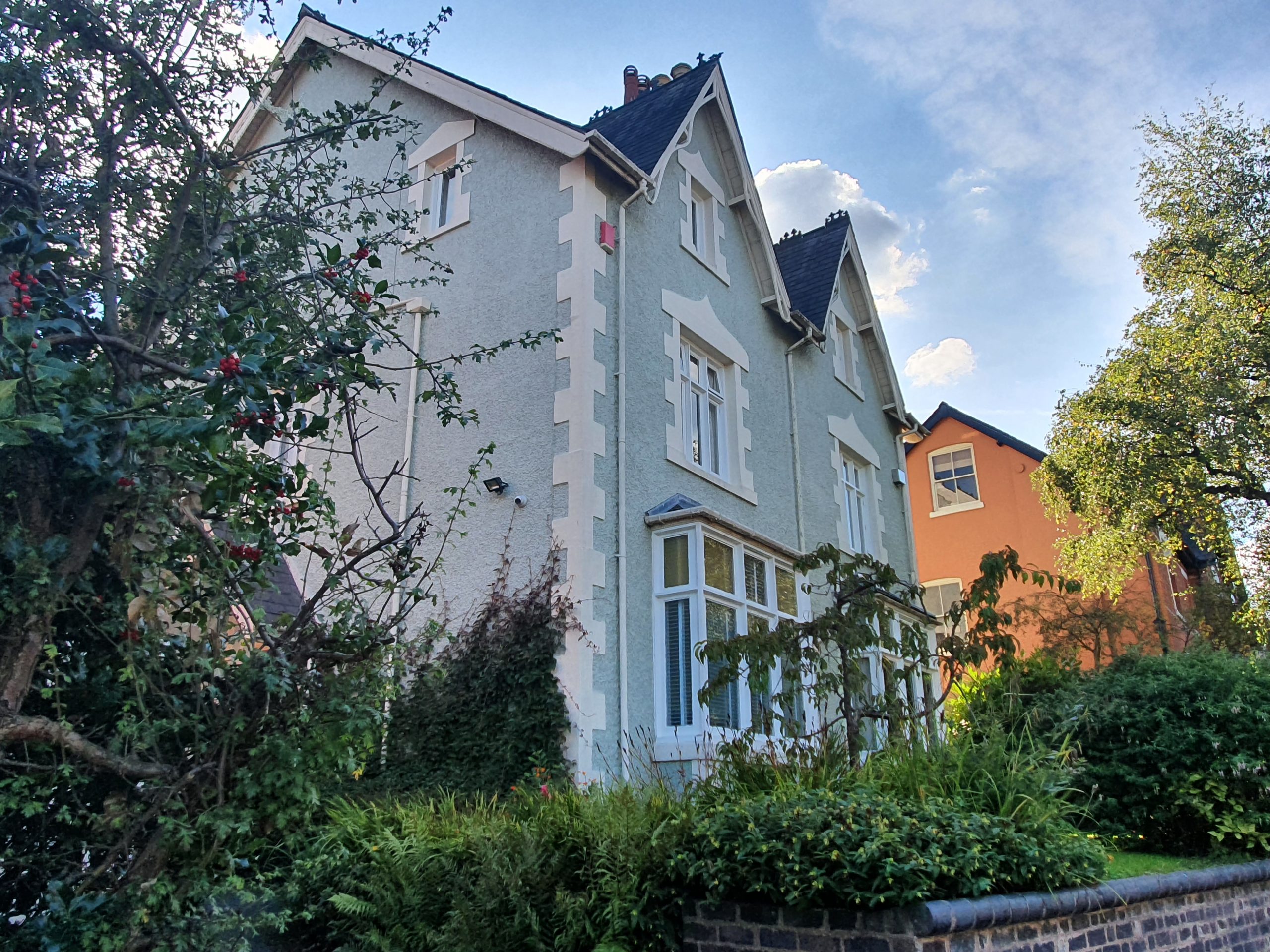
On your right is 18 Cotton Lane, formerly known as ‘Ivy Cottage’, which was the house to which Tolkien’s Suffield grandparents moved from Ashfield Road in 1904 or 1905. For Tolkien, the address was one of the ‘childhood memories which are a large ingredient in the make-up of the Shire’. Consequently, as a ‘private jest’, he gave the maiden name of Cotton to Sam Gamgee’s wife in The Lord of the Rings. After Emily passed away in 1914, John Suffield did not move house again before his own death in 1930.
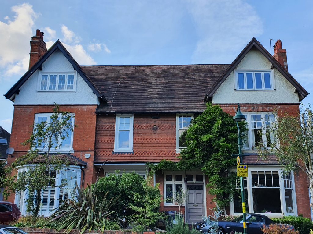
Opposite the house of Tolkien’s grandparents are two conjoined residences at the end of Grove Avenue. The one on the right is no. 58, known as ‘Glen Lynn’, which was the home of John Suffield’s cousin, Thomas Hillman Suffield (1834-1925), and of his wife and daughters. Thomas himself does not appear at this address in the 1901 and 1911 census records because, like John in his later years, he was a travelling salesman.
Tolkien’s youngest paternal aunt, Florence Mary Hadley (1863-1944), had also lived on Grove Avenue shortly after her 1888 wedding to a solicitor, Tom; probably in a house 150 metres further along the road.

Keep going for 270 metres to the mini-roundabout at the junction with Oxford Road, at which point go straight over and continue for a further 320 metres. At the bottom of Cotton Lane, where it strikes Wake Green Road, turn left. As you walk westwards along Wake Green Road for 100 metres, cross over to the pavement on the north side.
On the right is the house of Tom and Florence Hadley at the time of the 1901 Census, then called ‘Kylemore’ and now either 45 or 47 Wake Green Road. Tom Hadley would live only until the year 1911, after which Florence followed her son Wilfrid Arthur ‘Roy’ Hadley (1889-1981) to British Columbia, Canada. From there, Roy maintained a correspondence with J.R.R. Tolkien until the 1970s.

After continuing for a further 20 metres along Wake Green Road, turn right and walk down Mayfield Road for 210 metres, before turning left onto Forest Road. Walk for 100 metres north-westwards along Forest Road.
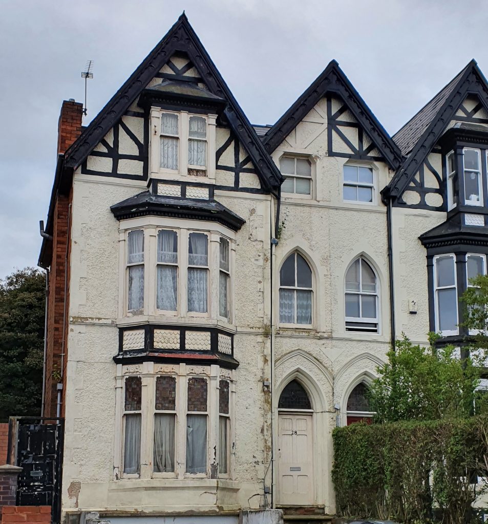
On the left is 28 Forest Road, formerly known as ‘Elmdon’, where Tolkien’s father lived while working as a clerk at the Moseley branch of Lloyd’s bank in the late-1880s. Arthur Tolkien (1857-1896) would have been living here when he met Mabel Suffield in 1887.
Continue along Forest Road for another 60 metres to the mini-roundabout at the junction with Anderton Park Road. This is the walk that Tolkien’s father would have taken to work in the 1880s.
Look to the left, southwards along Anderton Park Road. On the righthand side of the road, about 100 metres distant, was ‘Carisbrooke’ (or no. 130): a now demolished house where Tolkien’s eldest paternal aunt Mabel Mitton and her family lived at the time of the 1901 Census.
Also somewhere on Anderton Park Road, during the Second World War, occurred a sad event in the history of the Suffield family. Nora Murrell Marris (1861-1940), a first cousin of Tolkien’s mother, was an author who wrote and lectured on the life of Joseph Chamberlain but was handicapped by partial blindness. On this road, during a blackout in 1940, she was knocked down and killed by a passing motor vehicle.
Cross straight over the mini-roundabout and keep walking for a further 240 metres along Forest Road.
On the left is 4 Forest Road, which is likely to have been ‘Stockwood’, in 1901 the house of a cousin of Tolkien’s mother, Mary Hamilton Marris (1865-1914), who was a teacher.
After another 50 metres, there is a crossroads at which Forest Road becomes Woodbridge Road. Cross straight over and proceed for 300 metres along Woodbridge Road to the junction with the A435 Alcester Road.
On the left is a building which also features in the description of the Moseley Ring: the former branch of Lloyd’s Bank where Tolkien’s father worked during the late-1880s.
Use the crossing on your left to traverse the Alcester Road. Once you’ve reached the far side of the road, turn right, walk northwards for 25 metres and then turn left onto Chantry Road. Proceed along Chantry Road for 70 metres.
On the left is 56 Chantry Road, also known as ‘Woodville’, which was the home of Tolkien’s eldest maternal aunt Edith May Incledon (1865-1936) and her family, at the time of the 1901 Census. In 1890, she had married Walter Bury Incledon in St Anne’s Church, the steeple of which will soon become visible above the houses on the right as you walk further along Chantry Road. When they moved into Woodville, it was newly built on a tract of the Moseley Hall estate, with access to a private park at the rear encompassing the estate’s erstwhile fish pond and icehouse. We know that Tolkien bonded with his Incledon cousins, concocting imaginary languages with them, so it is not impossible that they played together in the park and that he retained a memory of the icehouse, which bears some resemblance to a Hobbit-hole.
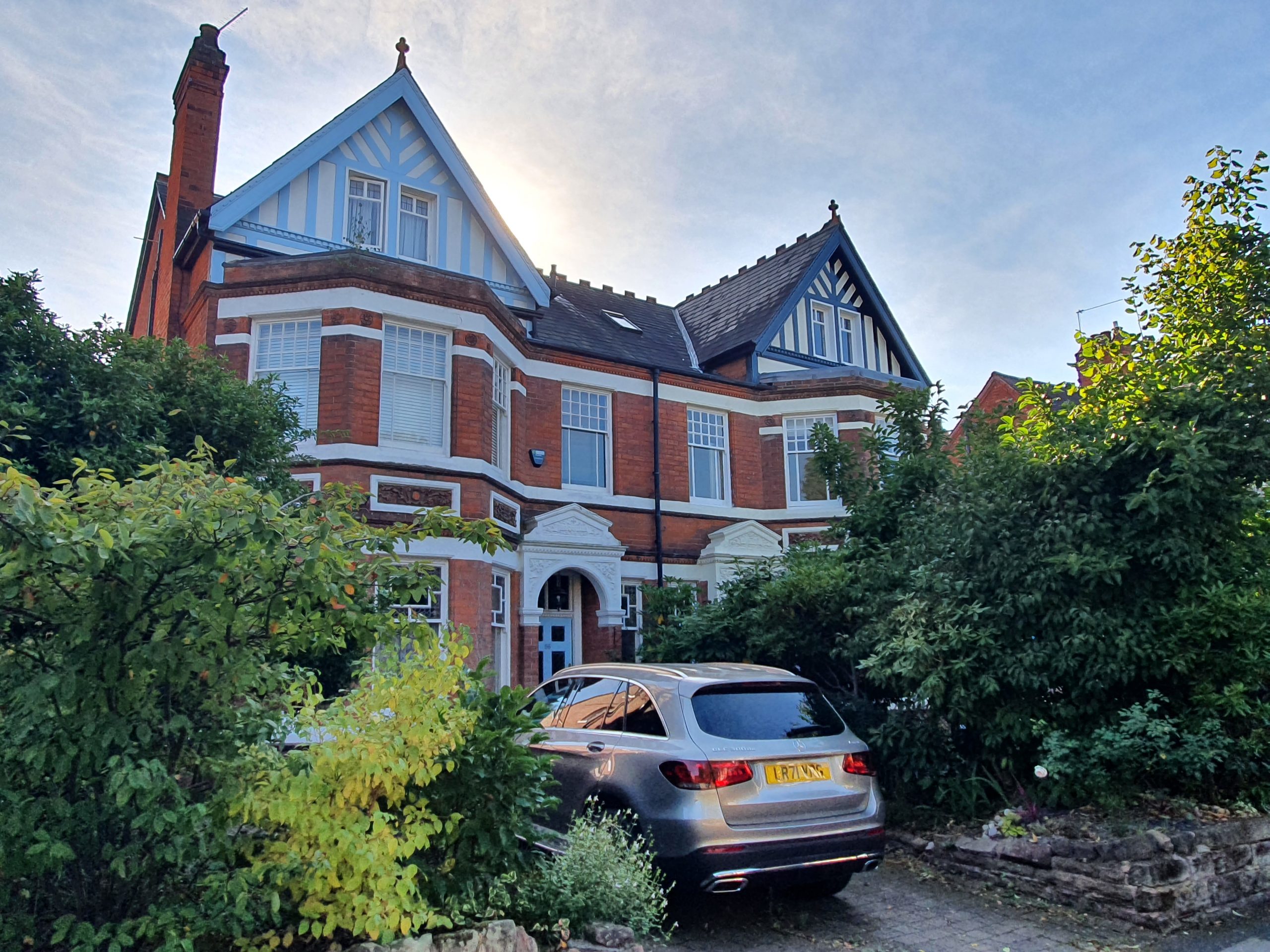
Follow Chantry Road gently downhill for a further 380 metres, to the point where it bends sharply right.
An entrance to Moseley Park is on the left, beyond 14 Chantry Road. The park is open every Wednesday from 10am to 4pm and on the last Saturday of the month.

After Chantry Road has curved right, follow it for another 120 metres to the crossroads with Park Hill.
Look to the right for a better view of St Anne’s Church, where Tolkien’s Aunt May was married in 1890.
Carry straight over Park Hill and continue along what has become Augusta Road for 100 metres before turning left onto Strensham Hill. After going 140 metres downhill, cross over the junction with Edgbaston Road and proceed 170 metres to the end of Strensham Road. Upon reaching Mary Street, turn left and walk downhill, towards the high-rise buildings of Birmingham city-centre which you can see in the distance. After 150 metres, turn left onto Hallam Street.

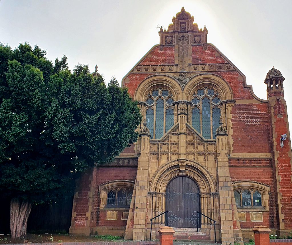
Follow Hallam Street for 120 metres as it bends right and downhill. Where Willows Road meets it from the left, keep right and continue for another 140 metres to a crossroads. There, turn left onto Edward Road and proceed for around 250 metres. Opposite the Edward Road Baptist Church, which has a somewhat Tolkienesque main door, turn right onto Cheddar Road before almost immediately turning left into Calthorpe Park.
Enter the park between the Calthorpe Wellbeing Hub and the basketball court. Continue for 100 metres, passing a play-area on your left, and cross the footbridge over the River Rea.

On the other side of the bridge, follow the path for 50 metres as it first curves left, back towards Edward Road, and then to the right. Proceed along this same path for 300 metres, going diagonally across Calthorpe Park. At the north-west corner of the park, take one of the paths around the grass ‘island’ and exit the park by the lodge on the corner of Speedwell Road and the Pershore Road. Use the crossing on your left to traverse the Pershore Road. Having attained the opposite pavement, turn right and walk 25 metres before turning left onto Speedwell Road. Proceed for 170 metres to the top of Speedwell Road, at which point turn right and use the crossing over the Bristol Road. On the far side of the Bristol Road, continue north-eastwards for 100 metres.
On the right, beyond the bus stop on the opposite side of the road, was the site of 382 Bristol Road, where Tolkien’s maternal great-grandfather, his second wife and four sons were living at the time of the 1861 Census.
Continue in the same direction along the Bristol Road for 200 metres and then, after the shops on your left, take a sharp left turn onto Wellington Road.
In this area, near the junction of the Bristol Road and Wellington Road, was 2 Haydn Place, where Tolkien’s paternal grandfather and his second wife lived during the late-1840s. It was probably here that he first met Mary Jane Stow (1833-1915), who would become his third wife and Tolkien’s grandmother, for the 1851 Census has her living at 1 Haydn Place as a teenage girl.
Walk 300 metres up Wellington Road and then turn right onto Charlotte Road, reaching the junction with Gough Road (and what is now called Woodview Drive) after a further 180 metres.
In this vicinity (probably near the junction on the north side of Woodview Drive) was 81 Gough Road, the first marital home of Tolkien’s maternal aunt Edith May Incledon, as recorded in the 1891 Census. The mother and brothers of her new husband also lived on Gough Road, at what was then no. 69. Another neighbour on Gough Road was Professor Henry W. Crosskey (1826-1893), the leading authority on Birmingham’s many glacial boulders.
Keep following Charlotte Road for another 350 metres as it climbs uphill and past the now redundant St James’s Church. After Charlotte Road curves left and becomes St James Road, continue for 200 metres to the crossroads with Wheeleys Road beyond a crest in the hill.
Having crossed Wheeleys Road, if you look to your left, you will just be able to see the site of a house (no. 62) where J.R.R. Tolkien’s paternal uncle Wilfrid Henry Tolkien (1870-1938) lived at the time of the 1911 Census. It is about 100 metres down the hill, on the left.
Remain on St James Road and walk for a further 300 metres uphill to the junction with Frederick Road.
On your right, 90 metres away and on the righthand side of Frederick Road, is no. 11, where J.R.R. Tolkien and his brother stayed for a few days late in 1909, after their guardian Father Morgan had discovered Tolkien’s romance with Edith Bratt. The family with whom the boys were soon to lodge on Highfield Road, the MacSherrys, had stayed in this same boarding house some years earlier and may have suggested the temporary arrangement. Also living on this road at the time (three houses further along) was Professor William Bywater Grove (1848-1938), a botanist educated at King Edward’s School and eminent in the field of mushrooms and other fungi.
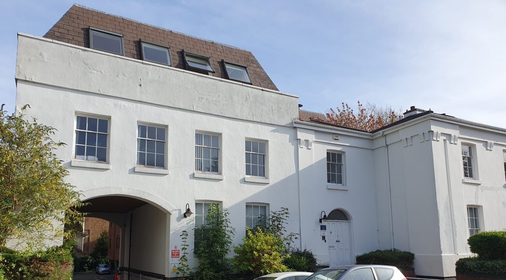
After another 150 metres St James Road meets Calthorpe Road, at which point turn left. Take the next right 100 metres further on, which is Greenfield Crescent, and walk a further 150 metres westwards.
On your left is 12 Greenfield Crescent, which was the home of Tolkien’s closest school-friend, Christopher Wiseman, from his birth until leaving for university. Their friendship began in 1905 and, though more distant in later life, lasted until Tolkien’s death. The author would name his third son Christopher. Wiseman’s father was the President of the Wesley Methodist Conference and described by Father Morgan as ‘The Pope of Wesley’, but the boys’ religious differences seem to have brought them closer. In 1917, after their friends R.Q. Gilson and G.B. Smith had been killed in the First World War, Wiseman wrote to Tolkien, ‘As you said, it is you and I now, Greenfield Crescent and Gothic, the old and original’.
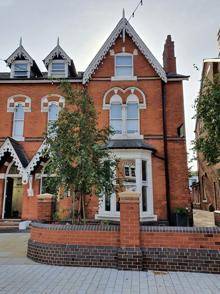
Walk another 100 metres along Greenfield Crescent to the junction with Harborne Road.
It was no doubt at this spot that Tolkien and Wiseman would meet to begin their daily walk to King Edward’s School, initially by turning right onto Harborne Road. Later, Wiseman would write to Tolkien comparing a disagreement over poetry to the ‘Old days, Harborne Road and Broad Street again… A grand old quarrel!’ Frequent topics of fiery discussion on their walks seem to have been philology and their contrasting Christian beliefs, which Tolkien described as the ‘moving force and at the same time the foundation of both [of us]’.
Leave the young Tolkien and Wiseman to their disputatious commute and instead turn left onto Harborne Road; then walk 130 metres to the junction with Highfield Road.
Straight ahead, 170 metres further along Harborne Road and on the righthand side, is no. 93 (formerly no. 29), where Tolkien’s maternal great-grandparents (and grandfather, John Suffield) lived at the time of the 1851 Census. One of their neighbours (in a house on the site of the Chamber of Commerce) was the influential Unitarian preacher George Dawson.
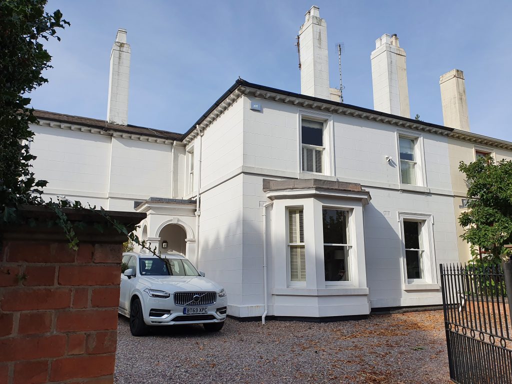
Turn right onto Highfield Road and walk 150 metres, passing Nicholson Drive on your left.
On the left is 4 Highfield Road, which was J.R.R. Tolkien’s home from late 1909 until autumn 1911, and his last long-term residence in Birmingham. His hosts were parishioners of Father Morgan: Julia and Thomas MacSherry, the director of a whiskey company from County Tyrone in Ireland. Unlike the house on Stirling Road, Tolkien must have been able to invite friends to visit; in a 1914 letter, Wiseman begs Tolkien to attend a meeting ‘by all the memories of VT [Vincent Trought, who had died in 1912], of Gothic, of binges in Highfield Road, of quarrels about philology’.
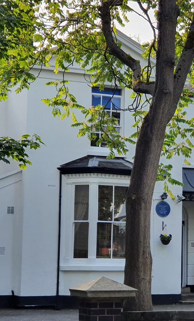
At the end of Highfield Road, 50 metres further on, is the A456 Hagley Road. Here, you are at the centre of Tolkien’s north Edgbaston neighbourhood:
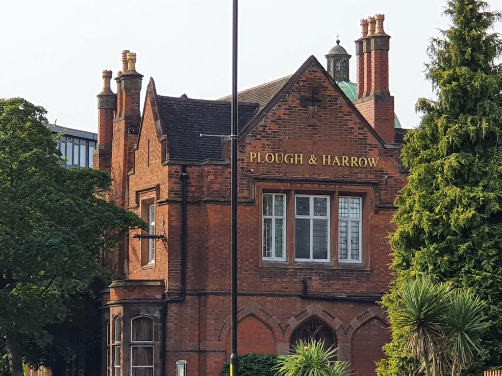
Straight ahead, on the other side of the Hagley Road, is The Plough and Harrow Hotel, where Tolkien and his wife spent the night of 3rd June 1916, before he left Birmingham for the fighting on the Western Front. According to Robert Blackham, the Tolkiens’ room was no. 116. Tolkien described leaving his wife as ‘like a death’. Happily, it transpired that they were able to bring their children to stay at the Plough and Harrow years later.
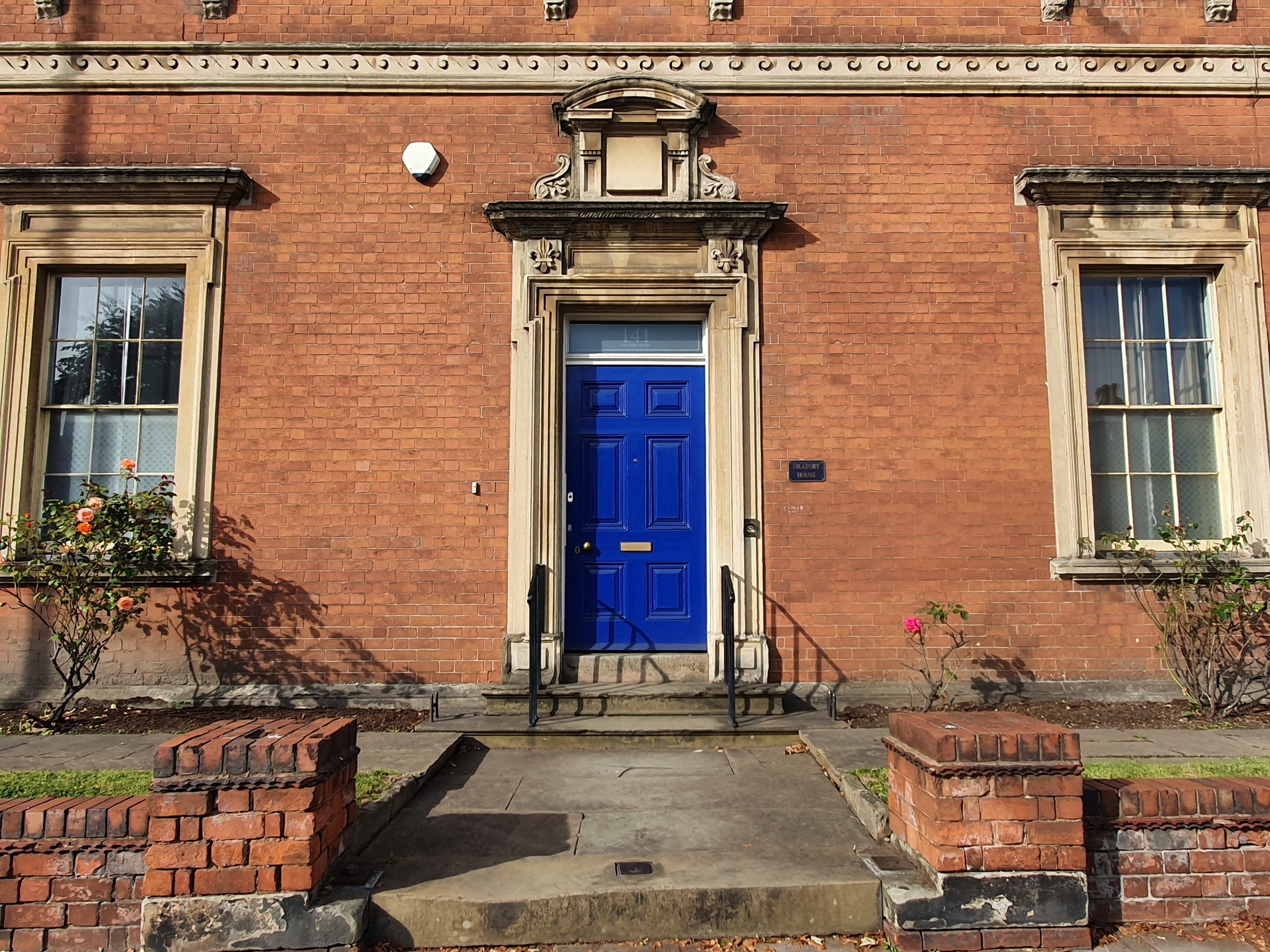
To the left of the hotel is the Birmingham Oratory: Tolkien’s church from 1902 until 1911, the home of his guardian Father Francis Xavier Morgan (1857-1935), and, briefly in 1902, where Tolkien was schooled. Here was established the first English community of the ‘Congregation of the Oratory’ by John Henry Newman in 1848. The scholar Maggie Burns believed that Newman’s Oratory House influenced Tolkien’s description of Bag End in The Lord of the Rings. In a letter, Tolkien wrote that he had been ‘virtually a junior inmate of the Oratory House, which contained many learned fathers (largely “converts”)’ and this gave him ‘the advantage of a (then) first rate school and that of a “good Catholic home” – “in excelsis”’. After he left Birmingham, Tolkien returned to visit Father Morgan at the Oratory in October 1914 and again in March 1916; on the latter occasion to tell him the news of his impending wedding to Edith. By then, it was too late to accept Morgan’s offer of the Oratory as a venue for the nuptials.
As you emerge from Highfield Road, use the crossing on your right to reach the north side of the Hagley Road and then turn right and walk 100 metres. Turn left into the drive called Loverose Way, between no. 115 and a derelict circular building called Vancouver House. Follow Loverose Way northwards for 130 metres and then for 10 metres as it curves left. Take the narrow gate on your right and a short flight of steps down to Duchess Road.
Between the summer of 1908 and autumn 1909, Tolkien and his brother lived in a boarding house on Duchess Road (either no. 21 or 37) run by a Mrs. Louisa E. Faulkner. Mrs Faulkner put on musical recitals for the Oratory priests in which one of her boarders, Edith Bratt (1889-1971), sang and played the piano. Edith, herself an orphan, soon bonded with Tolkien in the face of Mrs Faulkner’s authoritarian ménage. By 1909, the pair’s friendship had become a romance, involving nocturnal conversations held via their open bedroom windows and culminating in a clandestine bicycle trip to the Lickey Hills. Tolkien remembered the abode as a ‘gloomy, creeper-covered house, hung with dingy lace curtains’, on a ‘rather decayed road’. Sadly, Mrs Faulkner’s boarding house and all of the Victorian terraces nearby were torn down in the 1960s, but one can still imagine Tolkien eagerly turning his bicycle left at the end of the road, on the way to his rendez-vous with Edith.
From the steps onto Duchess Road, turn left and walk the 50 metres to Beaufort Road. Turn left again and walk 150 metres to the junction of Beaufort Road and Plough and Harrow Road. Ahead is another view of the Birmingham Oratory. At Plough and Harrow Road, turn right and walk 180 metres to the junction with Monument Road.
On your right is the site of 185 Monument Road, an address which Tolkien used in 1917. Straight ahead, on the other side of the road, is the 100-foot tower built in 1758 and known as ‘Perrott’s Folly’, or ‘The Monument’, or ‘The Observatory’. Between 1884 and the 1970s it was a weather station, replete with meteorological equipment and a telescope (from the Greek for ‘far-seeing’). Thus Perrott’s Folly may be one possible source of inspiration for the concept in Tolkien’s fiction of palantiri or ‘far-seeing stones’, which are generally found atop of towers.
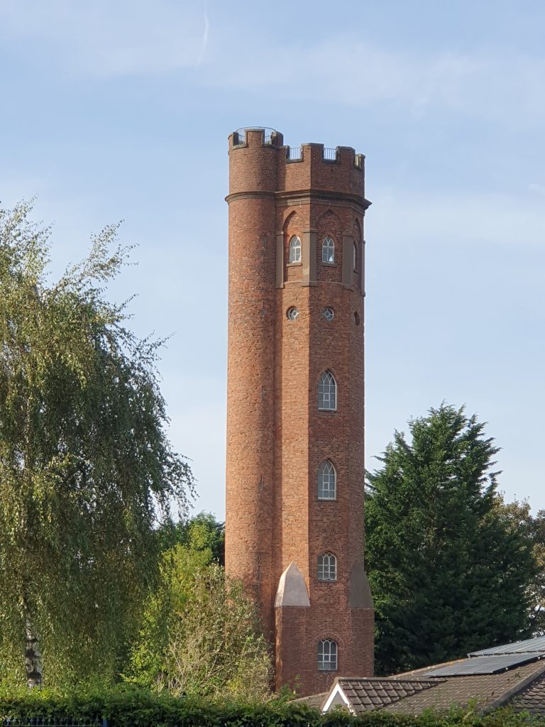
Monument Road, in front of you, takes the same line as the Roman road known as Icknield Street. It bears some resemblance to the course of the East-West Road in Tolkien’s Shire, except that it is 20 miles from south Birmingham to the bridge at Bidford, rather than the 40 miles from Bywater to the River Brandywine. Turn left onto Monument Road and follow it southwards for 200 metres to the junction with the A456 Hagley Road.
On your left is The Ivy Bush, a pub which Tolkien certainly walked past many times and the name of which he used for a ‘small inn on the Bywater road’ in his Shire.
If you look 130 metres to your left, you’ll see no. 96 on the far side of Hagley Road. At the time of the 1901 Census, this was the house of a cousin of Tolkien’s mother. George Suffield Marris (1857-1936) ran a successful iron foundry, manufacturing stoves and kettles. It could be that George Suffield Marris appears in Tolkien’s fiction as Bilbo’s cousin Otho Sackville-Baggins. Tolkien explained in a letter how the ‘headship [of some Hobbit families] might pass through a daughter of the deceased to his eldest grandson’ and that, in such cases as Otho, ‘the heir… took the name of his mother’s family – though he often retained that of his father’s family also (placed second)’. In the same fashion, George was the eldest grandson of John Suffield (sr.) and received the family name via his mother.

Turn right (as you look southwards from the entrance of The Ivy Bush) and cross over Monument Road. Walk 250 metres along the north side of the Hagley Road, then turn right again onto Stirling Road and walk another 100 metres.
On your left is the site of 6 Stirling Road, where the widow and children of Dr Joseph Sampson Gamgee (1828-1886) lived in the late 19th and early 20th century. Although the family lived opposite Tolkien’s 1905-1908 house, the author claimed their surname found its way into his fiction only indirectly. Tolkien said the word ‘gamgee’ was used in his childhood to mean ‘cotton wool’, hence the character of Samwise Gamgee marries Rosie Cotton. Only later did the author learn that ‘Gamgee tissue’ was named after its inventor, a Birmingham doctor called Sampson Gamgee. It is anyway interesting that Tolkien probably sat next to Sampson Gamgee’s son at a King Edward’s School Governors’ meeting in February 1938, while writing the early chapters of The Lord of the Rings.
Continue northwards along Stirling Road for a further 20 metres, as it bends to the right.
On your right is 25 Stirling Road, which was home to Tolkien and his brother from January 1905 until the summer of 1908. It was perhaps as a form of compromise with the boys’ family that Father Morgan agreed to pay for them to lodge with the widow of their uncle William Suffield, not far from the Oratory. Tolkien and Hilary had a bedroom on the top floor, overlooking the street and the factories of Smethwick beyond. Tolkien hated the view, according to his biographer. Nor did he and his brother develop a warm relationship with their Aunt Beatrice, who ‘thoughtlessly burnt the personal papers and letters of their deceased mother’.
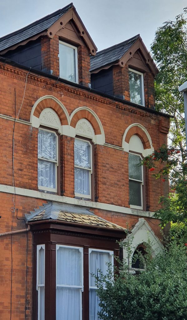
Continue for 250 metres to the end of Stirling Road. Ahead and to the left is the 100-foot chimney of the Edgbaston Waterworks, popularly and erroneously cited as one of the ‘Two Towers’ in the title of the second volume of The Lord of the Rings. Turn right onto Waterworks Road and, almost immediately (after 30 metres), turn left onto Harold Road. Proceed 250 metres to the end of Harold Road, where it meets Reservoir Road.
Straight ahead is Coxwell Gardens, which in turn leads to Oliver Road, where Tolkien lived (at no. 26) from early 1902 until the spring of 1904. The house was apparently ‘only one degree better than a slum’ and has now been demolished, along with the other Victorian-era buildings on the same road. It was here, shortly before Christmas 1903, that Mabel Tolkien was first stricken by symptoms of the diabetes that would cause her death within one year.
Turn left onto Reservoir Road and follow it for 300 metres, whereupon it passes through a ‘gate’ (just a metal frame) and bends left and downhill towards Edgbaston Reservoir. Join the footpath that runs around the edge of reservoir, following it in a clockwise direction. Remain on the footpath for around 800 metres as it winds right and then left along the southern shore. At the south-west corner of the reservoir, take the path that forks left and gently uphill from the reservoir to Rotton Park Road. Having emerged through a gate onto Rotton Park Road, turn left and walk 100 metres to the junction, where a right turn onto Portland Road is required. Follow Portland Road uphill for around 350 metres to the minor crossroads with Gillott Road. Go straight over at the crossroads but in another 50 metres turn left and downhill onto the footpath known as the Harborne Walkway, which follows the line of an old railway cutting. Follow the Walkway for 350 metres and then turn off to the right onto Percival Road, which is just 50 metres long. At the end of the road, turn left and continue for 120 metres along Stanmore Road, to where it meets Fountain Road and the A456 Hagley Road. Cross over Fountain Road and walk along the north side of the Hagley Road for 200 metres, reaching the fork where Sandon Road goes off to the right.
The narrow promontory between Sandon Road and the Hagley Road was formerly the site of the tall, neo-Gothic public fountain (constructed c. 1870) to which Tolkien refers in his early poem ‘The Battle of the Eastern Field’. In the mock-heroic poem about a rugby game on the King Edward’s School pitches in south Edgbaston, Tolkien describes the school captain (or head boy) G.F. Cottrell as the ‘Chiefest Lord/ From the Fountain’s lofty ridge’. The fountain was dismantled in the mid-twentieth century.
At the fork, keep to the north side of Sandon Road and walk 300 metres, crossing over Carisbrooke Road and then City Road.
On your right is 49 Sandon Road, where the aforementioned George Frederick Cottrell, the son of a commercial clerk, lived at the time of the 1911 Census. Sadly, G.F. Cottrell was killed in the fighting near Ypres in May 1915.
Continue along Sandon Road for another 300 metres, at which point Poplar Avenue joins from the right.
On the left-hand side of Poplar Avenue, 480 metres distant, is the house where William Joseph Slim (1891-1970) was living in 1911. Bill Slim would go on to become Britain’s most successful general of the twentieth century, appointed field marshal and viscount, but during the 1909/10 season he played rugby for the King Edward’s School 2nd XV, alongside J.R.R. Tolkien.
Keep going along Sandon Road for a further 300 metres and then, at the junction with the A4030 Bearwood Road, cross straight over onto Three Shires Oak Road. You are now in the historic county of Staffordshire, as it was in Tolkien’s youth before 1911.

Proceed 500 metres up Three Shires Oak Road, past the junction with Wigton Road and Thimblemill Road, where there is a blue plaque marking the position of the ancient Three Shires Oak. This tree marked the boundary between Staffordshire, Shropshire and Worcestershire, but was uprooted around the year 1900. Pause at the junction of (what has become) Abbey Road with Pargeter Road and Park Road to admire the view behind you.

Continue along Abbey Road, initially for 200 metres, as far as the crest of the hill near a junior school on the corner of Barclay Road. On the other side of the hill, a further 150 metres down Abbey Road, take the short-cut on the left through the trees of Warley Woods Park. Where the track divides, keep to the right and on a line parallel to Abbey Road. This brings you out onto the open grass and then, after 150 metres, to the park’s main path. Follow the main path uphill for 150 metres, past a play-area and a drinking fountain. Here, turn right and take the path uphill through the trees for 270 metres, as it curves right and then sharp left. Upon reaching the golf course, turn around to admire the view once more.

Continue on the path across the golf course for a further 40 metres. Before reaching the park exit, turn left onto the path which runs parallel to Harborne Road and follow it for 230 metres.
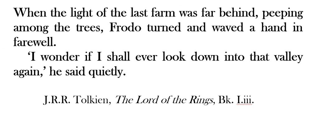
Take the park exit opposite the opening of Lenwade Road. Cross over Harborne Road and go down Lenwade Road for 100 metres before turning left onto Hadzor Road. Having crested Lightwoods Hill, the view you are now seeing is of Shropshire’s Clee Hills, 30 miles to the west.
Continue for 200 metres along Hadzor Road to the junction with Castle Road East. Take the short footpath and steps on the far side of Castle Road and then use the crossing on your left to traverse the A4123 Wolverhampton Road. Having reached the other side of the Wolverhampton Road, take Castle Road West on your right and then almost immediately (20 metres) turn left onto Kenilworth Road. After walking the 200 metres to the bottom of Kenilworth Road, turn left and follow Birch Road 200 metres uphill to the junction with the A456 Hagley Road West. Use the crossing on your right to reach the south side of the Hagley Road, where Leg 1A of The Shire Way ends.
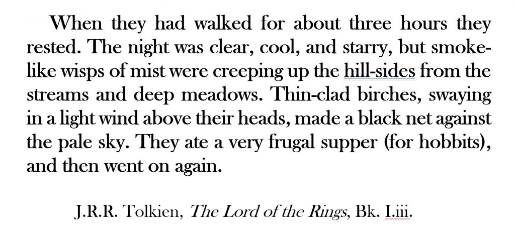
Aside from the nearby street names of Birch Road, Lane, Walk and Grove, there is a single swaying birch on the central reservation of the Hagley Road. On this spot on 28th October 1940, a Blenheim bomber piloted by a Polish airman crashed, having struck a barrage balloon cable above nearby Brandhall.
You may choose to eat your lunch at one of the nearby restaurants or, if you prefer, you could buy some food at the Co-op supermarket and picnic in Woodgate Valley Country Park (one mile further on), where there are certainly more birch trees.
NEXT: An alternative starting point in Birmingham city centre