Distance: 9.7 miles / 15.6 kilometres
Total ascent: 892 feet / 272 metres
Walking time: 3 to 4 hours
Stage 2 of The Shire Way begins with an almost circular loop around Rednal Hill, which does not correspond to the hobbits’ journey but does explore important sites relating to the author’s life.
Outside the front entrance of The Old Rose and Crown Hotel, face towards the lawn. Start by turning right and then left onto the road called Rose Hill. Walk 100 metres downhill and turn left again onto the Drovers’ Way that runs northwards between the golf course and Rednal Hill. After 650 metres, the path becomes Eachway Lane and converges with a private driveway. Keep left and continue for 100 metres more, almost as far as the road also called Eachway Lane.
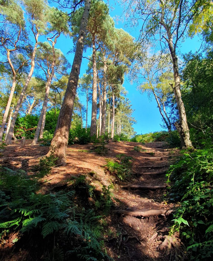
At the road, turn right but keep to the path through the trees above the carriageway for 100 metres. Ignore two opportunities to descend onto the road but instead turn right and go up onto Rednal Hill. After you’ve climbed the path for 60 metres, turn left onto another minor path across the grassy hillside and then go straight for 100 metres. This brings you down onto Leach Green Lane, where you should take care in crossing to the pavement on the other side. Now turn right and walk 150 metres along the east side of Leach Green Lane.
On your right is 206 Leach Green Lane, which may be the house where Tolkien stayed for a few months in the summer of 1909, while revising for an Oxford University scholarship exam. It would therefore also be the place where he and Edith Bratt had tea during a secretive visit from Edgbaston that autumn, the discovery of which by a furious Father Francis Morgan led to their long separation. According to Tolkien’s biographer, ‘The woman who had given them tea told Mrs Church, the caretaker at the Oratory House, that Master Ronald had been to call and had brought an unknown girl with him. Mrs Church happened to mention it to the cook at the Oratory itself. And the cook, who always liked telling tales, told Father Francis.’ Of the two semi-detached houses, built in 1901, no. 206 is on the left.
Continue walking along Leach Green Lane for 350 metres, until the junction with Lickey Road. Here, turn right and walk a further 130 metres along Lickey Road.
On your right, up a short driveway between The Hare and Hounds pub and Joe Joe Jim’s Bar, is 430 Lickey Road, formerly known as Woodside Cottage. This was the scene of the most pivotal event in Tolkien’s early life, the death of his mother. Father Francis Morgan had arranged for Mabel Tolkien and her boys to live in the cottage beside the entrance to Oratory House from June 1904 onwards, after she had spent some months in hospital and been diagnosed with hereditary (or ‘Type-1’) diabetes. With Mabel so unwell, the family had their meals cooked for them by the wife of the postman who owned the cottage.
Tolkien would look back on the summer of 1904 as one of his happiest, a return to the rustic life he had so enjoyed in Sarehole. Mabel recorded some of his activities in a letter to her mother-in-law: ‘We’ve had perfect weather. Boys will write first wet day but what with Bilberry-gathering – Tea in Hay [Mills] – Kite-flying with Fr Francis – sketching – Tree Climbing – they’ve never enjoyed a holiday so much.’ The frequent visits of Father Morgan established a strong bond with the young J.R.R. Tolkien, who now saw the priest in his more relaxed, pipe-smoking guise. Dismayed when the priest was obliged to postpone one of his visits, the twelve-year-old wrote to his ‘dear wise owl Francis’ on 8th August, telling him that he and Hilary had each ‘found two lovely walks to take you [on] when you do! come out here, which we hope will be soon’.
At summer’s end, Tolkien restarted school at King Edward’s. To get to Birmingham city centre, he had first to walk nearly two miles in the wrong direction: south, to Barnt Green Railway Station. On his return, which in late autumn was often after sunset, Hilary would go to meet him with a lantern. These must have been anxious days for the brothers for their mother’s health was deteriorating. In early November, Mabel Tolkien fell into a diabetic coma and on the 14th, with her sister May Incledon and Father Morgan present, she died.
At first, the orphaned Tolkien was utterly desolated. He tried to convey this feeling of being forsaken to his cousin Marjorie Incledon by ‘vainly waving a hand at the sky saying “It is so empty and cold”’. However, over time, he turned the memory of his mother into the foundation of his Catholic faith, which in turn was fundamental to creating The Lord of the Rings. In a letter to his son, he wrote: ‘…I think of my [young] mother’s death, worn out with persecution, poverty, and, largely consequent, disease, in the effort to hand on to us small boys the Faith, and remember the tiny bedroom she shared with us in rented rooms in a postman’s cottage at Rednal, where she died alone, too ill for viaticum…’
Continue southwards along Lickey Road for 50 metres and then turn right onto the lane between the red post and telephone boxes on the one hand and the convenience shop on the other hand. Follow the lane for 300 metres as it climbs Rednal Hill and bends around to the right.
Through the metal railings and trees on your right, you can catch a glimpse of the back of Oratory House, originally built for Cardinal John Henry Newman but used by the Oratory fathers as a ‘Retreat’. During the summer of 1904, the twelve-year-old Tolkien could often be found sitting on the veranda with the house dog, ‘Lord Roberts’, while Father Francis smoked his large Cherrywood pipe. Cardinal Newman is among those buried in the grounds of the Retreat.
Continue up the lane for another 150 metres and then take a sharp left onto the main path along the spine of Rednal Hill. Follow the main path along the ridgeline for 400 metres and then for a further 250 metres as it curves steeply downhill, first to the left and then to the right, down a flight of steps. If in doubt, look for a railing on your right that fences off several old quarries and follow it to the bottom of the hill.
You should emerge onto Rose Hill opposite the derelict Bilberry Tea Rooms, a building donated to the people of Birmingham by the Cadbury family in the year that Tolkien lived in Rednal (1904). Cross over Rose Hill, turn right and walk 50 metres uphill. Where the fence around the old Tea Rooms ends, turn left and use the makeshift stepping stones to cross over the stream. After 10 metres of climbing Bilberry Hill, turn right and follow the gentler path as it slants across the wooded hillside, ignoring the first switchback after about 20 metres.

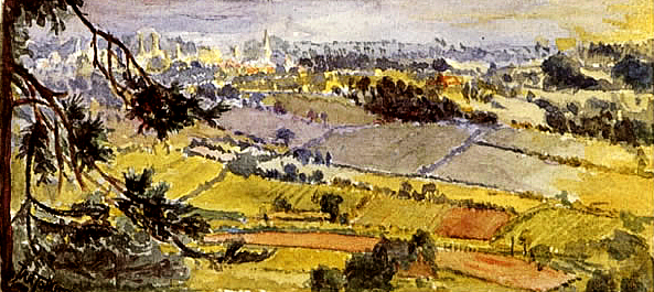
Once you have zig-zagged your way to the path that runs along the spine of Bilberry Hill, turn left and follow it for 200 metres. At a three-way division in the path, keep left, sticking to the path with views over the countryside to the east. After another 200 metres, just before a brick-walled observation point, there is a small clump of coniferous trees on your left.
One such tree appears on the left side of the view of Kings Norton (and distant Sarehole) that Tolkien painted from Bilberry Hill on 8th July 1913.

Continue southwards from Bilberry Hill. Where the footpath divides again, keep left and traverse an arm of the car park for the Lickey Hills visitors’ centre. Take one of the rough paths through the trees on the other side of the car park and, after 50 metres, turn left onto the track which runs along the top of Cofton Hill. After 200 metres you will reach the Cofton Hill viewpoint.

Continue following the path that passes to the right of the viewpoint, as it descends Cofton Hill. After 160 metres, at the edge of the trees, ignore the paths to left and right. After another 100 metres of descent, the path begins to curve around the end of Cofton Hill. At the bottom of the hill, where you encounter a path running parallel to traffic on the Barnt Green Road, turn right. After 80 metres, turn right again onto the bridleway which branches off the Barnt Green Road at Kendal End.
Barnt Green Road, on your left, is part of the route that Tolkien would have walked twice daily during the autumn of 1904, in order to commute by train to and from Birmingham. The woodland route you have been walking was not available to him at that time: Bilberry Hill and Pinfields Wood were not leased to the City of Birmingham until 1913.
Follow the bridleway gently uphill for 550 metres as it gradually bends right and you skirt Cofton Hill once more, lower down than before. Where the track joins another, straight bridleway, take a sharp left downhill and proceed for 200 metres. Then, follow the track as it bends right and crosses a stream.
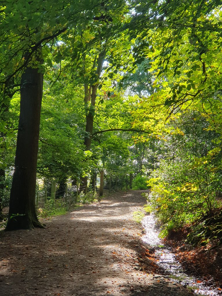
Beyond the stream the track curves uphill and to the left, but after a further 200 metres, drops and crosses another stream. Thereafter, the track goes more or less straight for 800 metres (ignoring the switchback halfway through on your right), taking you to the edge of Pinfields Wood on Cherry Hill Road. Here, cross the road and then footbridge on your left, which you to the fordrough through Cherry Hill Coppice. Proceed for 350 metres to emerge onto Fiery Hill Road, opposite Barnt Green Railway Station.
This was the railway station that Tolkien used in order to attend King Edward’s School during the autumn of 1904.
Turn right onto Fiery Hill Road and walk 250 metres uphill.
On your left is 30 Fiery Hill Road, known today as ‘Westfield’, which was home to the family of Tolkien’s aunt Edith May Incledon (1865-1936) from the 1900s until c. 1916. Humphrey Carpenter writes that it was ‘usual’ for Tolkien and his brother to spend their Christmas holidays here, although there is only evidence to confirm two such sojourns. For Christmas in 1912 Tolkien wrote a play entitled The Bloodhound, the Chef and the Suffragette, which his cousins Marjorie May (1891-1973) and Frieda Mary Incledon (1895-1940) performed for the family’s amusement. It was also from here, when Tolkien came of age on 3rd January 1913, that he wrote to Edith Bratt in Cheltenham to arrange their first meeting since March 1910; a meeting at which, to the astonishment of friends and family, they engaged to marry each other.
Tolkien seems next to have visited Barnt Green at the beginning of July 1913, bringing with him a new sketch-book. On 2nd July, he made a watercolour of a stand of wild foxgloves in a woodland clearing. It is impossible to locate the scene in question, but his watercolour of the view towards Kings Norton on 8th July suggests he may have been enjoying the new right of public access to Bilberry Hill and Pinfields Wood. On the 9th and 12th July, Tolkien made two watercolours of the Incledons’ garden, perhaps supervised by Marjorie, who would go on to study at the Birmingham School of Art. The second of these paintings captures not only the vivid colours of toppling foxgloves and delphiniums, but also the southern end of ‘The Cottage’.

Tolkien was once more a guest of the Incledons in Barnt Green at Christmas 1913, when on 16th December he played in the annual rugby match between the King Edward’s School 1st XV and the Old Edwardian Oxbridge undergraduates at the Eastern Road playing-fields in Edgbaston.
Keep going up Fiery Hill Road for another 600 metres and then, where there is a crossroads with Linthurst Road at the top of the incline, turn left. This brings you back to the East Worcestershire Ridgeway. Walk along Linthurst Road for 100 metres and then turn left onto a footpath which descends through the trees, beside a muddy stream. Ignoring a minor path on your left after a rightward bend, proceed straight along this path for 450 metres as it leaves the wood and keeps to the left side of a field.
Beyond the field, cross the wooden footbridge and keep left where the path forks a few metres further on. Continue for 300 metres, past Gorse Bank Cottage, to a bridge over the Bristol-Birmingham railway. Cross the bridge, turn right onto Blackwell Road and walk 450 metres, under the bridge carrying the M42. Fortunately, 50 metres after the motorway, there is a footpath along the right side of Blackwell Road.
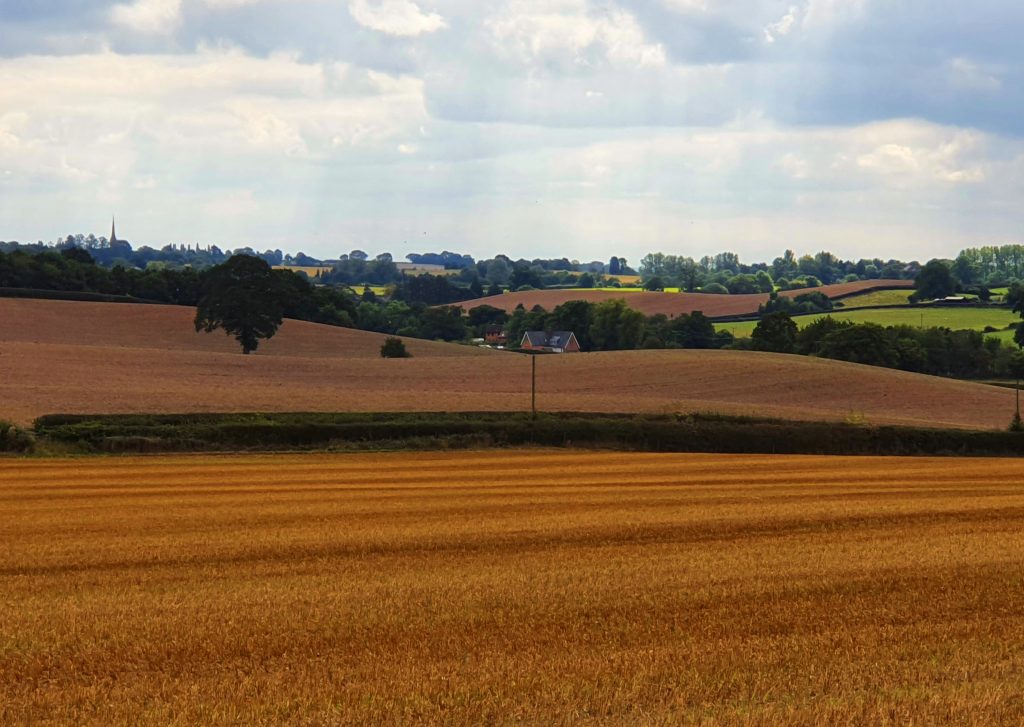
120 metres after the footpath ends and you have rejoined Blackwell Road, turn left opposite the road to Linthurst Newtown and onto a footpath across the fields. Keep to this path for 600 metres as it crosses two fields and passes to the right of Wheeley Farm. Upon reaching Wheeley Road (which is the East Worcestershire Ridgeway), turn left and walk 70 metres uphill to the farm entrance; then turn right onto the track opposite. Follow this track southwards for 800 metres.
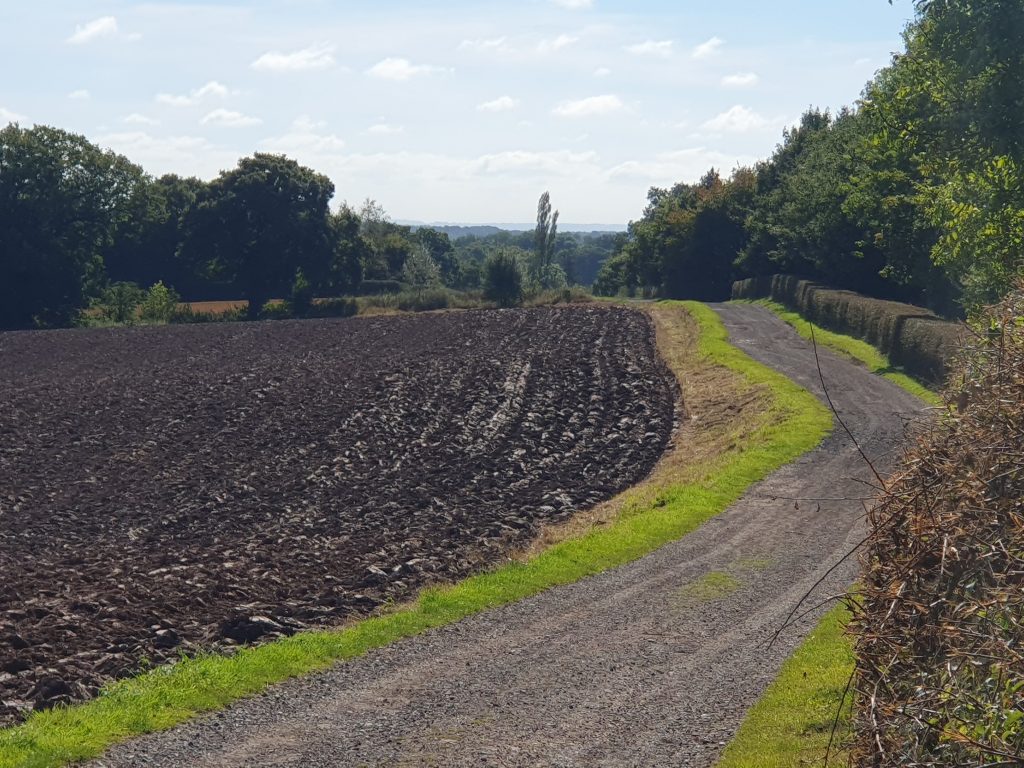
Enter Cattespool Farm and pass two barns on your right before turning right. Walk the 30 metres to the track on the far side of the farm and then turn right again. Another 30 metres brings you to a path on your left, which you should take for 600 metres between the fields. After the path descends and emerges into a large field, follow it to the right as it skirts along the hedgeline and then crosses in front of Cattespool Cottage. 100 metres beyond the cottage, turn left onto Agmore Lane and follow it for 500 metres to the junction with Stoney Lane. Here, take the road diagonally to the right (Wharf Lane) and follow it for 800 metres until striking Brockhill Lane.
Turn left onto Brockhill Lane, cross the bridge over the canal and then immediately turn right onto the unnamed lane before Ravensdale Cottage. Follow this lane, which goes steeply uphill for 450 metres, to the junction with Hewell Lane. By turning left onto Hewell Lane you are once more joining the Ridgeway. Follow the narrow footpath on the righthand/western side of the road for 725 metres, where Alcester Road turns off to the right.
Ideally, this leg of The Shire Way would carry on to Headless Cross, the Ridgeway’s highest point until the Cotswold Hills. However, as you will see, the proximity and the speed of the motor traffic plying Hewell Lane are inconducive to enjoyable walking. It is more pleasant to undertake another cross-country detour in the direction of the farm of Tolkien’s aunt in Dormston, ‘Bag End’. If refreshments are required at this point, the pub on the junction with Alcester Road, called The Tardebigge, may be a good place to rest.
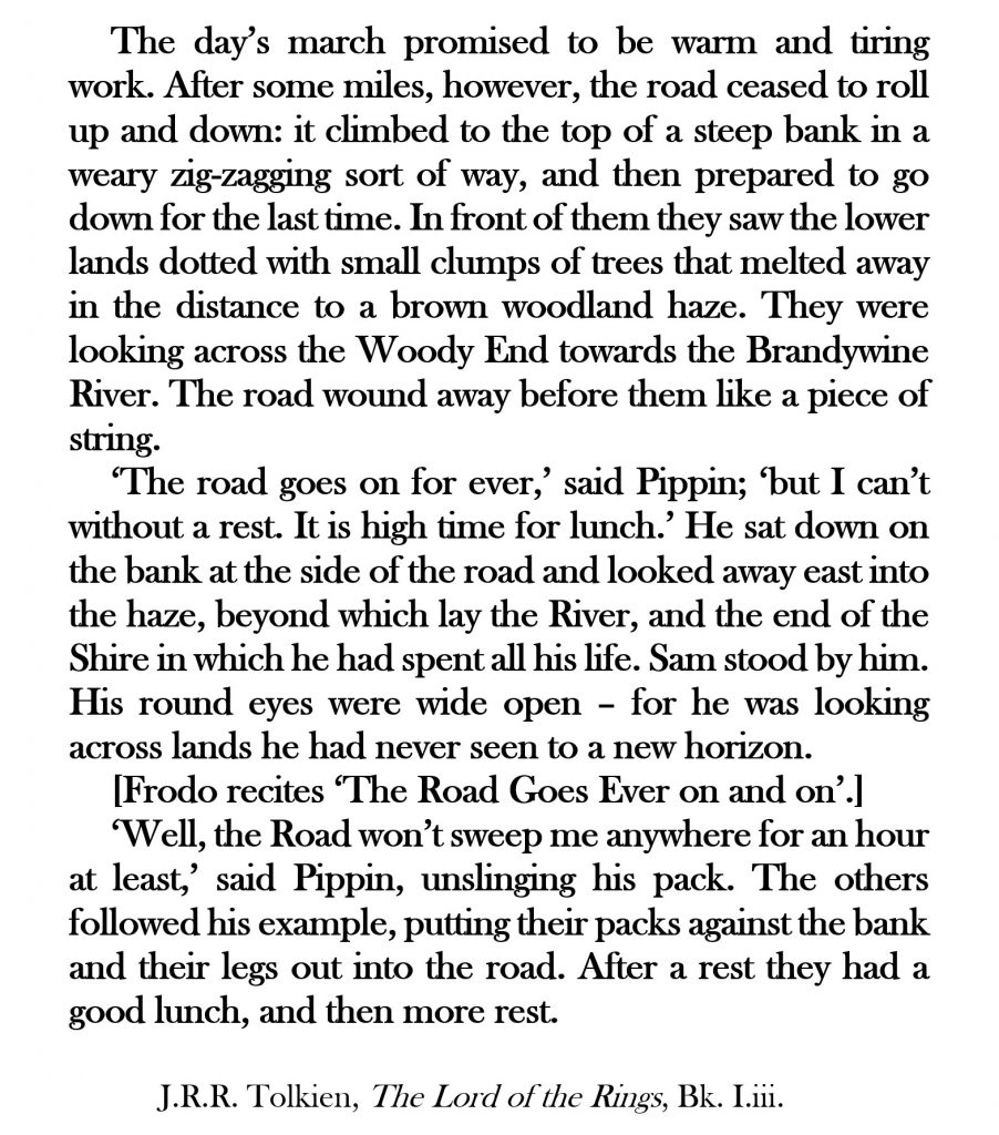
To complete Leg 2A, follow Alcester Road for 400 metres as it passes under the A448 Bromsgrove Highway and then bends through 90° to the right. Having ignored the first turn to the left (Holyoakes Lane), cross the road and take the second road on the left, High House Lane. After 80 metres, turn right onto Church Lane and proceed for 250 metres to St Bartholomew’s Church, Tardebigge.
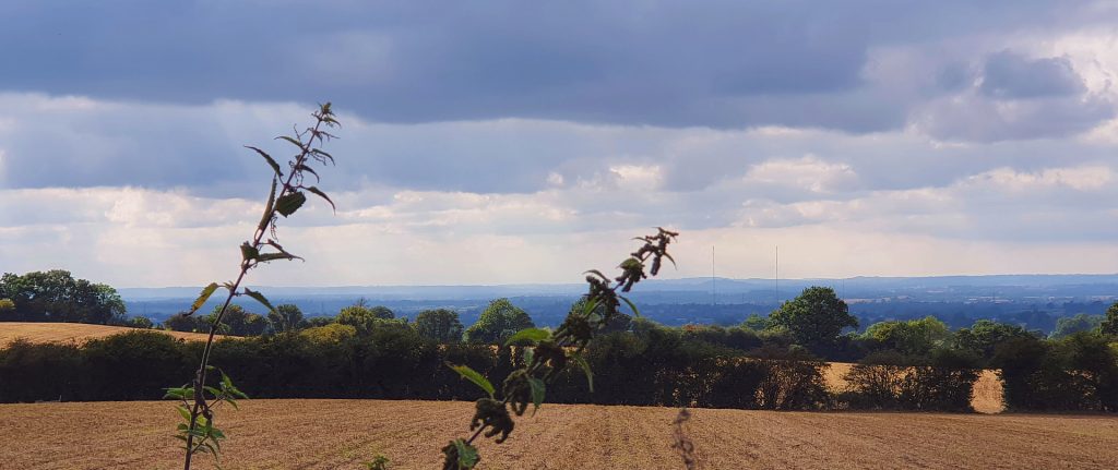
NEXT: Leg 2B of The Shire Way